 I have been playing around with augmented reality apps lately, seeing how they might be used for education and civic engagement. The field is still in its beginning stages, but we are already starting to see some interesting applications of AR.
Of course, augmented reality applications have been around since the early 1990s. But it has only been until the past couple of years the consumer grade technology has gotten to the point that you can literally have an augmented reality experience using a device in your pocket. And with various AR standards (open and proprietary) already on the market, the potential for AR is still uncharted.
One of the best examples of the educational value of augmented reality is LookBack Maps.
Today I ran around San Francisco trying out the free LookBack Maps app for the iPhone. Created by Jon Voss in 2008, Voss has a unique vision of the power of historical photos put in context:
"There’s something in being human that wonders what was here before us—who occupied this space, how did they live, what did they leave behind? By mapping the millions of historical photos available through public libraries and private collections on the web, we start to piece together the puzzle."
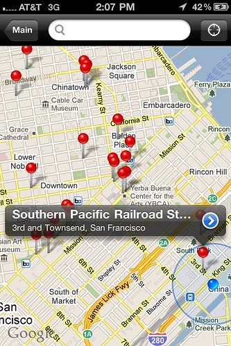 The LookBack Maps app combines GPS data, historical photos, and historical information to give the user a richer understanding of the history of a particular place in a unique and clever way.
The main map screen places you on a Google map of your area. Nearby locations where historic photos were taken are marked with a red marker.
I happen to be in the location where most of the historical photos are entered into the LookBack system: San Francisco, California. There are 200-some photos included on the SF Bay Area map, most within the San Francisco city area.
Not only does the map show you were you are in relationship to the photos, but a "guide me" function will lead you with arrows and a distance meter to a particular photo. It was fun just walking around having it lead me around to the next locale.
Clicking on a particular entry gives you more background on that location during the period when that photo was taken.
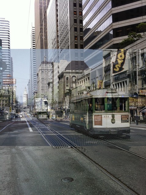
Once you are at the actual spot, you can call up a semi-transparent version of the historical photo, which is superimposed over the camera view of your phone. Trying to line up the photo with the actual view in front of you is not as easy as it sounds, particularly if it was taken from a strange angle or there are now buildings where an empty space once was. In a few cases I had to step out into the middle of an intersection and hope not to get hit by traffic as a I took a picture.
And once you have it lined up just right, you take a picture…
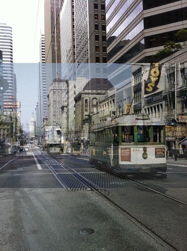
Juxtaposing the historical photo over a real life scene reveals a lot about what has changed and what has stayed the same about the city. You can see above how much the buildings around Market Street in San Francisco have changed since this picture was taken in 1957.
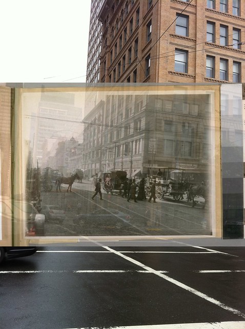
Here's an image from 1915 on the corner of Mission and 3rd Street.The building on the right remains, but the horses and buggies have been replaced by cars and trucks.
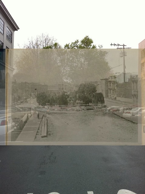
Using the app can also lead you down streets and neighborhoods that you might not normally visit. I had never seen this charming South Park in Soma before, which apparently has been a park since the late 1800s at least. Now I can't wait to go back and explore the area more.
I love the combination of historical data, a mobile app, and photography as a means of creating your own artifacts of what you have discovered. I could see this being a fun project for a history class to do , as part of a multimedia presentation about a particular period in history, or the story of a particular neighborhood. And with a team of students working together, you can literally place yourself into a scene from the past.
Of course, if you aren't in the San Francisco area, this app isn't much use to you… yet. That said, Jon Voss and his team has just released in March a new New Orleans app that does the same treatment to an archive of historical New Orleans images. I'd love to go to Louisiana and try it out! If ever there was a place in the US that is already steeped in history, it's New Orleans.
LookBack Maps has so much potential for education and travel. Hopefully this project will grow to include more parts of the country. Definitely worth checking out.
